Tuesday, 31 May 2016
Rural Alberta hazards May 14, 2016
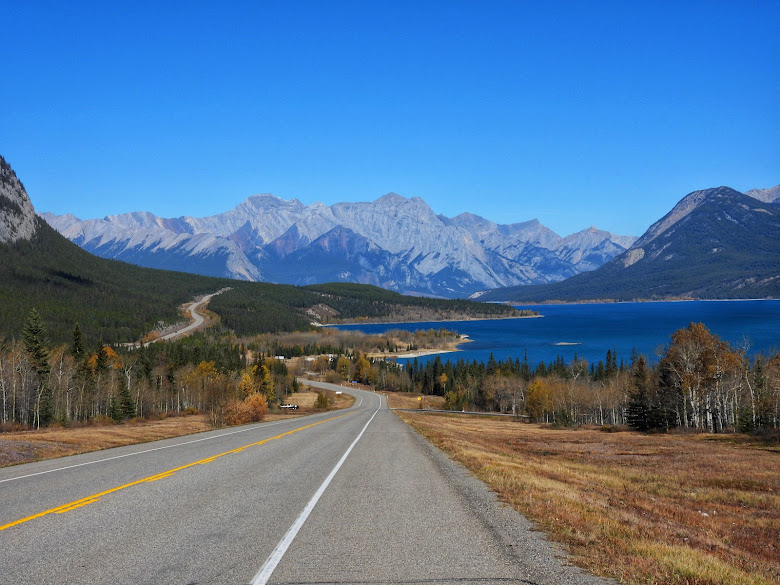
Somedays you are out in the middle of nowhere, or in this case along Highway 501 south of Etzikom, Alberta, and you have to pull off on a side road because about a million dollars of farm machinery is coming the other way. The farmer was towing an air seeder. When everything is spread out it spans seventy-six feet.
Monday, 30 May 2016
Allendale United Church
Due south of Clandonald, Alberta on May 1, 2016. It is not being used and it could be restored.
The year on the front is 1954.
If you walk in this is what you see. The pews and altar are still inside. The church has a complete interior. It has not been used in years. The floor is peeling. No interior shots were possible as the boarded up windows blocked the light. I used a flashlight for a brief look inside. I left it as I found it.
Sunday, 29 May 2016
Waterton National Park, May 28, 2016
My friend thought it would be funny getting a photo of me getting a photo of a very friendly resident.
Lundbreck Falls May 28, 2016
I always stop at this place if I am nearby. I finally got a photo of this place that I am happy with. This is just off Highway 3 near Lundbreck, Alberta.
Gimlet Missionary Church May 8, 2016
Sometimes you find stuff totally by accident. This is near Gimlet, Alberta. There is a hall and rodeo grounds at Gimlet and nothing else. It has the look of an old schoolhouse. The sign says it was established in 1933 so it may have always been a church. Some old schools were repurposed as halls and churches. I could not find any quick information. Maybe someone will stumble across this post and provide some background.
I really did not feel like hopping a well built barbed wire fence to get a closer look. I did not want to open the road gate either. There was no small gate for people.
Saturday, 28 May 2016
Old grave?
Spotted this on Highway 545 on May 21, 2016 close to the Saskatchewan border. There is a cross and it is fenced off so I am sure it is a grave. There is no name that I could see. The white chain is plastic so it probably replaced whatever was there before.
As a side note there is a old survey marker against a fencepost almost beside the grave.
Friday, 27 May 2016
Fertile Plains Cemetery
West of Maleb/Conquerville, Alberta May 14, 2016. Conquerville was also known as Maleb. The Spanish Influenza devastated many families in the area. There was a bit of a rebound. The school closed in the 1980's due to lack of enrolment. There is not much in the area now.
The marker says it was erected in 1975. The known graves are from 1912 to 1932. There are at least seventeen graves. Not all of them have headstones. One is unknown. There are two sets of unnamed twin boys that I guess died in infancy. Two other unnamed babies are listed. It is a big plot of land for the number of people interred. I think they thought the area would be more successful with more people settling in the area.
Mrs. Martin Brustad.
This one has been lost to time.
Except for the gate and marker in the centre you would almost miss this driving by.
Thursday, 26 May 2016
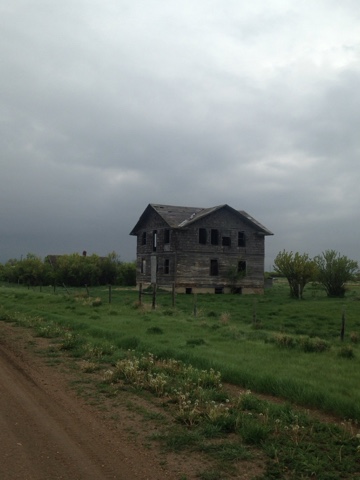
Abandoned house near Leedale, Alberta
Spotted this through the trees driving down a gravel road on May 8, 2016. It might have been a nice little house at one time.
Wednesday, 25 May 2016
The barn post April 17, 2016
My friend Ron spotted this when we were out by Hussar, Alberta. A lady was walking her two dogs and allowed us to go on the property to get a couple of quick photos. This barn is over one hundred years old.
Tuesday, 24 May 2016
Robsart, Saskatchewan May 21, 2016
This is basically a ghost town. I ended up here simply because I could not get to where I originally wanted to go. That is a destination for another day. Robsart has a few occupied houses and a lot of empty buildings. From what I understand the town has less than twenty residents. The town was founded in 1910 and incorporated in 1912. The decline started in the 1930's during the Great Depression. In 1929 and 1930 fire destroyed parts of the town. At its peak there were three hundred fifty residents.
It shows up on my road map. When you arrive there is no sign stating the name of this place on the highway.
The whole place can be seen via Google streetview.
Main street with those extremely wide streets typical of prairie towns. There are post boxes that are still used. I think one of the buildings looks like it might be used on an irregular basis. Of course it had to rain the day I was there.
Main street building.
Another building on main street.
Main street again.
This is on the street that runs southeast of main street. I drove to get some pictures and noticed signs saying "Private Property" on the house. I was not sure where the private property actually started so I did not venture closer. The foundation looks recent so maybe it is being used for something.
This is close to the above house. Abandoned truck.
Various abandoned houses.
I believe this is the old hospital. From internet sources it opened in 1918 and closed in the 1930's.
Highway 21 north of Robsart on my way to Maple Creek. Beware of rural Saskatchewan highways. They can be very narrow.
Monday, 23 May 2016
That did not turn out how I expected
The long weekend is drawing to a close. Three days of wet miserable weather. On the plus side I did some blog housekeeping, added some labels and cleaned up some future posts. My laundry is up to date so I have got that going for me.
Otherwise I am waiting for the weather to clear up and warm up so I can take the bike out.
Victoria Day
Victoria Day Weekend! The most Canadian of all weekends. Victoria Day is in recognition of Queen Victoria and all that she has done for our nation. It is also the unofficial long weekend start to the summer season.
Sunday, 22 May 2016
Subscribe to:
Comments (Atom)


