Showing posts with label Ghost Towns. Show all posts

Thursday, 21 December 2023

Ghost town Saskatchewan

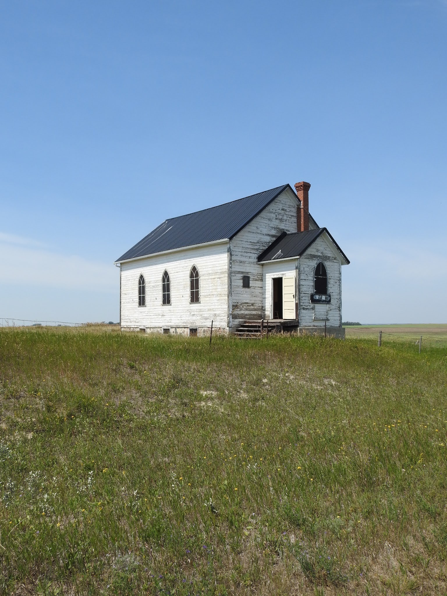
Dunkirk is a ghost town located south of Moose Jaw. The hamlet was the fourth waypoint on the mini-alphabet CPR rail line (Archives, Buttress, Crestwind) between Moose Jaw and Assiniboia.  The post office operated from 1913 to 1968. In its prime Dunkirk contained a number of businesses including two grain elevators and a school.  The slow demise of Dunkirk like many towns and hamlets on the prairies began during the depression.

                                            - Dale Redekopp


Monday, 10 July 2023

Abandoned Alberta

Founded in 1915, Nemiskam was the original spelling and is native for “between two valleys”. It is a ghost town located between Foremost and Etzikom north of H61, (the Red Coat Trail) and was once known as Bingham.

In the 1960s it had a population of 54, which declined to 17 in 1966, to 8 in 1971 and only 2 today. During the prosperous years, the town had a community hall, four grain elevators, a school and a service station. The last grain elevator was destroyed in 1990's. There are now six buildings left.

Nemiscam is still a popular spot for ghost towners.

              - Dale Redekopp


Thursday, 25 May 2023

Abandoned British Columbia

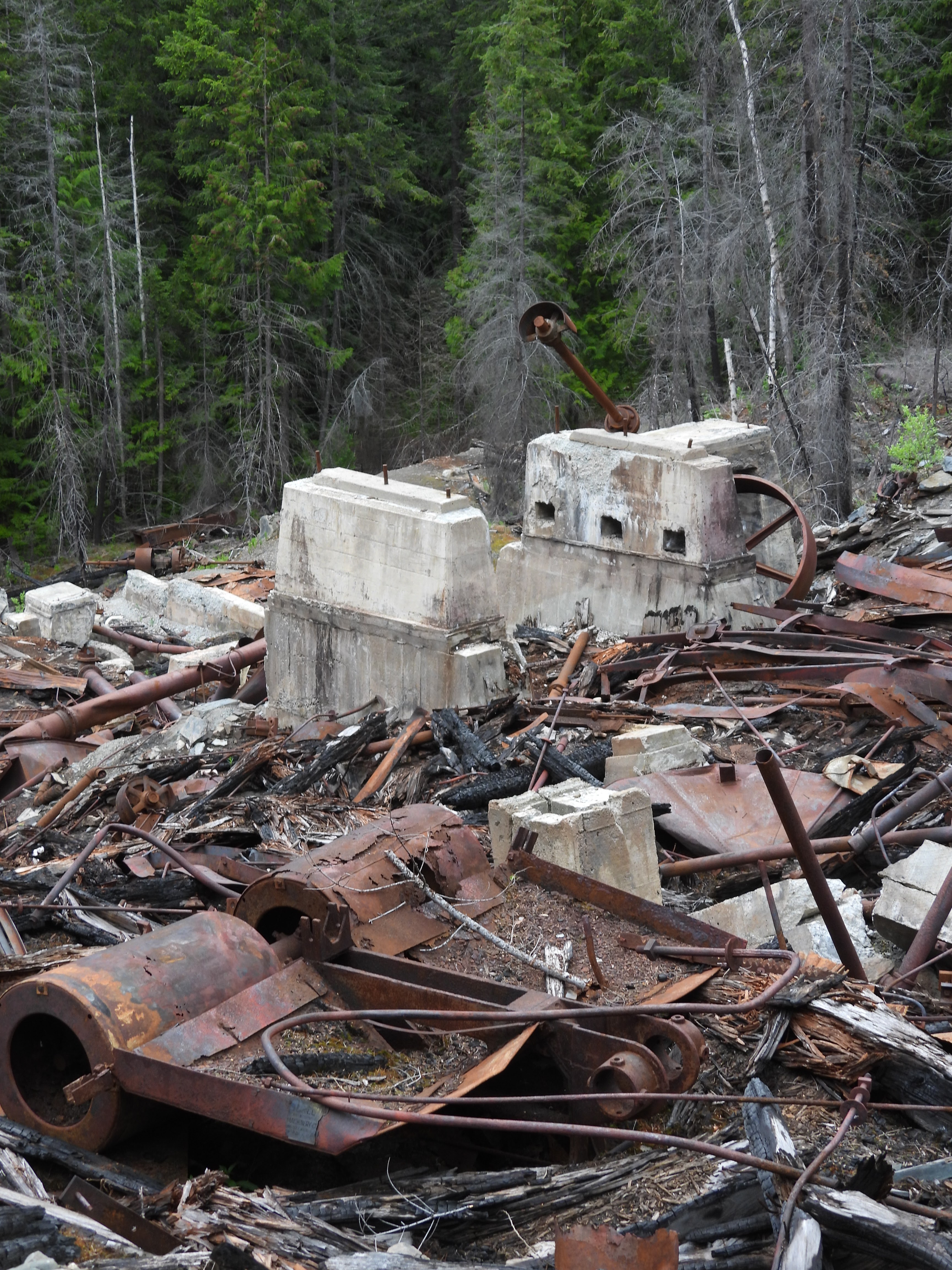
The ghost town of Alamo, British Columbia. Below is the remains of an old wagon at the site high above the ruins.


Alamo was a Canadian Pacific Railway siding and mining site. There was a concentrator and hydro-electric generating plant. The place was originally known as New Duluth. The mine was staked in 1892. In 1894 a concentrator and mill were built here and the mines were worked off and on for about forty years. In 1904 there were houses, bunkhouses, a school, stores, a post office and a population of about two hundred people. By 1955 a flood and forest fire damaged the area and everything was abandoned.

Along Highway 31A between New Denver and Kaslo there is a turn off to Sandon. Just off the intersection there is a small lot where you can park and walk the Galena Trail to Alamo. The trail is well marked and easy hiking and about three kilometres one way.

Great trail. Quiet, it is like walking in the forest on the west coast. Sometimes you are walking on a old rail line, other times you are walking on the remnants of old trails and roads that people traveled many years ago.


Old pieces of mining equipment can be observed along the trail.


Along the creek.


Little waterfall running down the mountain alongside the trail.


The trail takes you to the bottom of the mining operation. You can see the old rail ties embedded in the foreground in the photo below.


At the top looking down you can see various foundations, cable, pieces of equipment. A friend was with me. We explored at the top, there is cable from an old tramline. There is probably stuff we missed and we do want to do a return trip.


If you keep hiking, just past Alamo on the Galena Trail is a cable car to cross the creek to continue to New Denver. I did not take the cable car, I was not continuing on the trail. The water level was also high with spring runoff.

Tuesday, 2 August 2022

At one time Wheatstone, Saskatchewan looked like this . . .

If you type Wheatstone, Saskatchewan into Google Maps it will show you the location. This is the only photo I could find of what it once looked like. I cannot find the source because I misplaced my notes on this place. It was in a online local history book. I was unable to find how long the place existed.


This is what it looks like now. This was on a long abandoned rail line between Kayville and Ormiston. I have been to a few ghost towns where nothing exists except a marker saying a town once existed. If there is a marker I did not find it. 

This trail crosses the old rail line.


The next two are looking at the old rail line east and west.


North of the old rail line there is an old abandoned house off in the distance. This might be all that is left of Wheatstone. It is in a field behind a barbed wire fence.

Friday, 21 January 2022

Abandoned Alberta

What remains of Raley, Alberta. People once lived here and at one time there was a rail line and three elevators. Bored, and feeling the need to get out, I drove here and back last Sunday because I had never seen this elevator. It says Alberta Pacific on the side and was built in 1905. It might be the oldest elevator that is still standing in this Province. It is not far from Cardston, Alberta.


Wednesday, 8 September 2021

Neptune, Saskatchewan

There is nothing in Neptune, Saskatchewan. No sign marks where it once stood and there are no remains that I could see. Google Maps will show you where it used to exist.


There is a school marker. Close to the school marker on the other side of the road and a little south is a maintained cemetery with no name on it. Why someone chose Neptune as a name for a place on the prairie would be interesting since it is so far from the ocean.

Tuesday, 7 September 2021

All that remains of . . .

Senate, Saskatchewan. A sign and nothing else.


Friday, 27 August 2021

Ghost town Saskatchewan

Govenlock, Saskatchewan August 22, 2021.


This is the highway that runs by it. From here it is about twenty minutes to the US border. At one time Govenlock had a train station, a few grain elevators, two general stores, a service station selling Fords, a hotel, and various other business. It was thriving during prohibition. Four warehouses were filled with alcohol to supply bootleggers from the States. Over time the town dwindled down to nothing.


All that is left is the hall and some markers note the place.


There are post office boxes. If you look in every direction you do not see much civilization so someone has to do a bit of travel to get their mail. 


The horizontal line is the old rail line.


Some foundations behind the fence.


Just barely up the road is where an old school once stood. Nothing but empty prairie around.

Monday, 16 August 2021

Ghost town Saskatchewan - Pheasant Forks

Pheasant Forks was an agricultural colony formed by Methodist settlers from Yorkshire England and Ontario in 1882. 

The two-room school was built in 1920 and is the third school to be built in the community. It was closed in 1947 due to declining enrolment.


The church was built in 1905 which replaced one built in 1883. Regular services ended in 1963.


The church, school, and historic marker are all that is left of the former colony.